Skip to content

OUR SERVICES

Innovative Solutions for our Clients

CIVIL ENGINEERING/CONSULTING

Providing excellent services in civil engineering and site development permitting is an important facet of each project we put our name on. What sets us apart is our ability to offer services ranging from conceptualization through construction of a project for new commercial office buildings, retail space, industrial parks, mixed-use and planned developments; to residential communities, college/university expansions, private and public municipalities.

LAND SURVEYING & MAPPING

We provide a wide variety of land surveying services for public- and private-sector clients. From plat preparation toHydrographic studies, we perform a wide variety of comprehensive surveying services for commercial and residential developments, buildings, highways, bridges, utilities, waterways and property acquisitions. Our experienced staff utilize state-of-the-art equipment and practical innovation to reduce survey costs and expedite the completion of projects, while maintaining a superior product for our clients.

GIS SERVICES

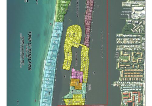
Engenuity Group, Inc. provide a wide range of digital mapping and Geographic Information Systems (GIS) consultancy services, helping organizations to better understand and benefit from the data we provide. We offer a wide range of GIS solutions and have a strong, established presence in both the Public and Private Sectors.

CIVIL

  • Master Drainage Systems
  • Water Management Studies and Design
  • Roadway Design and Permitting
  • Water Distribution and Sewer Collection Systems
  • Design and Permitting
  • Paving, Grading and Drainage –  Design and Permitting
  • Earthwork Analysis/Digital Terrain Modeling
  • Marina Design and Permitting
  • Seawalls and Docks – Design and Permitting
  • Hydrographic Studies
  • Park Designs
  • Land Development Services
  • Construction Observation Services, Certification of Completion
  • Quality of Control Evaluations
  • Plan Review and Evaluation
  • HOA/POA Turnovers
  • Municipal, Water Control District and “CDD” Consultant

SURVEYING

  • Boundary Survey
  • Topographic Survey
  • Tree Survey
  • Route Surveying
  • Plat Preparation
  • Plat Review
  • Coordinate Geometry
  • Mean and Ordinary High Water Surveys
  • Flood Elevation Certificate
  • Bathymetric and Hydrographic Studies
  • Coastal Surveying
  • Right of Way Maps
  • Control Surveys
  • Prepare Condominium Documents
  • Construction Layout
  • Record Drawings
  • Special Purpose Surveys
  • Legal Descriptions and Sketches
  • CAD Services
  • Expert Witness Services
  • Drone Mapping and Photography

GIS SERVICES

  • Analysis
  • Consulting
  • Conversion
  • Data Capture
  • Design
  • Enterprise Systems
  • Integration
  • Maintenance
  • Mapping
  • Presentations
  • Support
  • Training
Back To Top